


Summer continues to fly by! We’re now two-thirds of the way through what we consider to be “Meteorological Summer”, which runs from June 1st to August 30th. In the first days of July, I gave my grand prediction for a continuation of hotter and drier than average conditions here in central Illinois. I also teased the potential return of severe storms and heavy rainfall mid to late month.
July 2020 did come through hotter than average, but periodic thunderstorms did indeed return mid-month and pushed us to an average July rainfall in Champaign-Urbana. The average temperature in C-U was 77.2 degrees, which is 2.3 degrees above the July average of 75.0. We received 4.73″ of total rainfall, which is just barely above the average of 4.7″ in the Twin Cities.
July came in hot, and the heat didn’t break until the final two days of the month. Out of 31 days, only 6 were “cooler than average”, and it wasn’t until July 30-31 that we saw an afternoon high temperature that was not in the 80s or 90s. That being said, even in a purely hot and humid pattern, we did generally avoid what I’d consider to be extreme heat. The heat peaked shortly after the 4th of July holiday, with a high temperature of 93 degrees on July 6-7. High humidity helped keep overnight low temperatures quite warm, with temperatures failing to drop below a muggy 70 degrees at times offering folks without air conditioning little time to cool down.
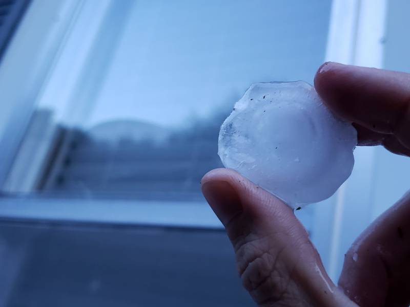
Photo by Andrew Pritchard.
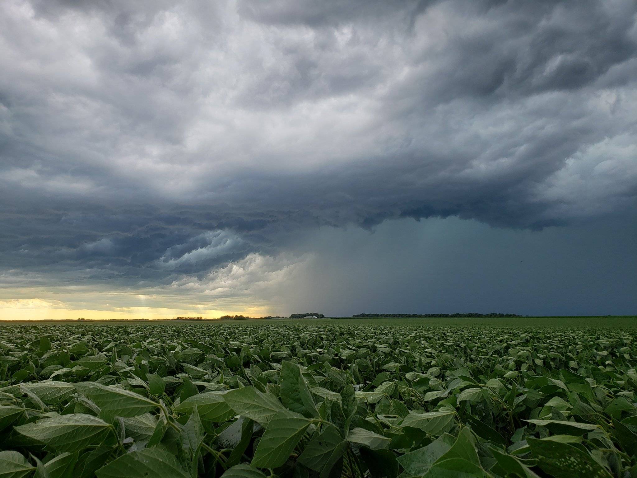
We got off to a dry start in July with regional drought issues beginning to crop up in the agricultural world. Dry weather came to an abrupt end with severe storms slamming Champaign County on July 11th. 1.96″ of rainfall was measured on the 11th, but it was hail that stole the headlines. Hailstones the size of golfballs pummeled portions of Champaign-Urbana (and nearby communities like Philo) for 10 to 15 minutes, leaving behind a trail of destruction. Even your friendly local meteorologist was not exempt, as our Urbana home had windows blown out and our siding destroyed.
The storms on July 11th brought the highest single-day rainfall total to C-U in July, but additional thunderstorms every 2-5 days helped push us to that 4.73″ monthly total. So the book closes on a hot July in 2020 with average precipitation in Champaign-Urbana.
So where are we headed for August? We’re certainly off to a cool start! A major shift in the jet stream pattern has delivered a round of cooler, less humid air to the Midwest that has our highs in the 70s and overnight lows in the chilly 50s. This early taste of fall is to be short-lived however, with heat and humidity on the rise again as we head into the second week of August. A transition toward a stormier pattern looks possible as well as we head into the middle of the month.
With all of that being considered in tandem with a fairly murky view into the 3-4 week timeframe I’m calling for an August 2020 that is near average with both temperatures and precipitation in Champaign-Urbana. For context, the average monthly temperature in C-U is 73.4 degrees and our average monthly precipitation is 3.93″ in August. This means we should generally be seeing afternoon high temperatures in the lower 80s, with overnight lows in the low to middle 60s. We’ll flirt with summer heat again at times, and I do still think we’ve got a few 90 degree days left in summer 2020. Additionally, with the return of periodic thunderstorms will come the potential for severe weather once again.
Andrew operates Chambana Weather, where he publishes daily weather information for Champaign-Urbana and surrounding communities. He also serves as Senior Meteorologist with Nutrien Ag Solutions at Research Park, focused on domestic and international weather and its impact on agriculture.
Champaign-Urbana monthly climate statistics are courtesy of the Illinois State Water Survey.