


Can you believe we’re already in the first week of August, staring the end of summer in the face? I was just reminiscing about how much I dreaded the month of August when I was a kid. In June, summer has only just begun. July, you’re right in the thick of it Nothing else matters! But when the calendar turned to August, it was all over. Back to school is just around the corner, the sun is setting a little earlier each evening, and that first shot of crisp, cool air looms on the horizon.
I find myself welcoming the end of summer 2022. Perhaps it’s mostly older age and a growing intolerance for heat and humidity, but I get the sense I’m not alone this year. This summer has been a drag. It’s been hotter than usual, and we’re all cranky about being missed by every single thunderstorm in central Illinois this summer — except for last Wednesday evening, of course!
I thought it would be interesting to look back at just how hot and dry it has been across Champaign County through the first two months of summer, and then take a look at what things look like as we enter another seasonal transition period in the Midwest (see: unpredictable).
Summer hit us with heat and dryness immediately, and that’s helped to make this summer feel rather endless. The same can be said about those winters where we’re hit with heavy snow or an early arctic chill around Thanksgiving — by February we’re all a shell of our former selves.
The drought started sneaky early. While we did carry a “year-to-date” water surplus, meaning we were “wetter than average” for the year through mid-May, the months of April and May were both drier than average. April to July are the wettest months of the year annually in Central Illinois. When you start shaving off rainfall from the first half of that period you’re going to start losing ground rather quickly.
April precipitation was 1.42″ below average, and May was 0.66″ under, so we entered the month of June with a 2″ moisture deficit over the previous two months.
Then came the heat. With moisture being depleted slowly, our defense against big June heat was already weakened. The middle of June brought record breaking heat to the Midwest. We set a new record on June 15th with an official high temperature of 99 degrees, though I know a few thermometers in the area surpassed 100. Overnight lows only fell into the middle and upper 70s, leaving very little time to cool off.
Ninety degree heat continued off and on through the end of the month, with June finishing just shy of 2 degrees warmer than average. Combined with only 0.81″ of rainfall for the entire month, a month that typically sees 4.5″ of rain from summer thunderstorms, the hot June sun quickly evaporated what moisture was left from early spring rains and we developed flash drought across the region.
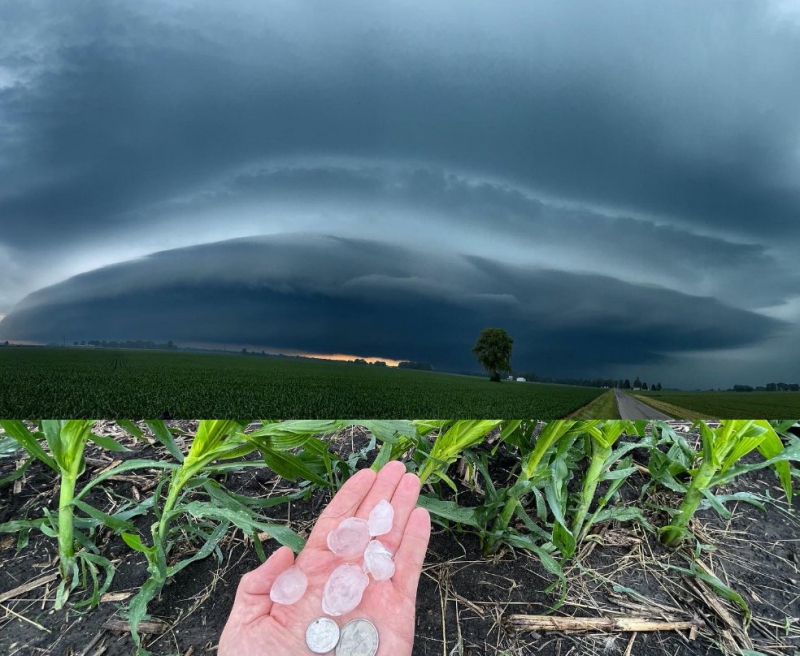
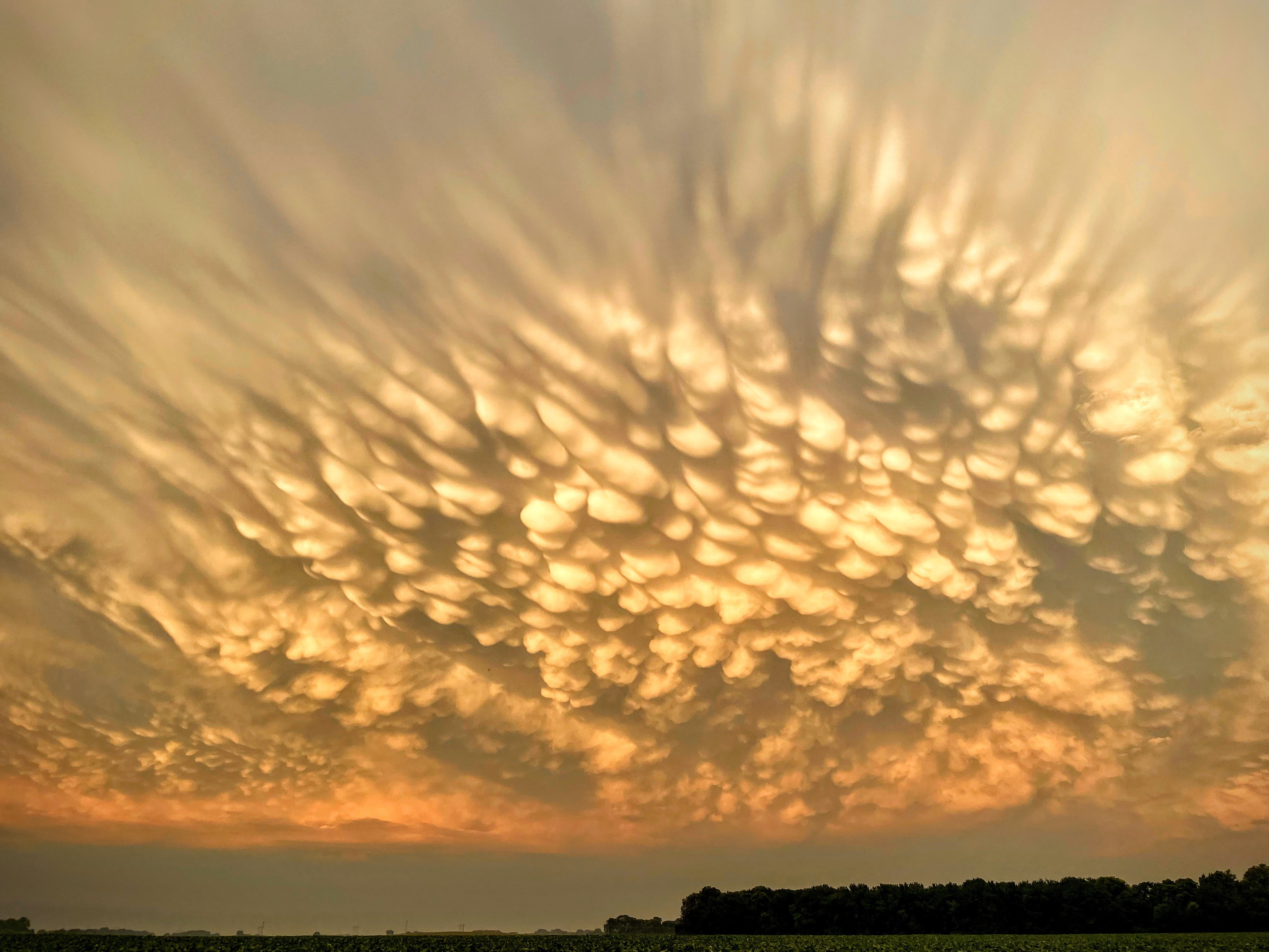
Images by Andrew Pritchard.
We’re familiar with the term flash flood in Central Illinois, often occuring when slow-moving thunderstorms produce a lot of rainfall across an area over a short period (a few hours) leading to localized flooding. Rather than a long-term drought (covering a period of 6-months or more) a flash drought occurs when drought conditions develop rapidly, over the span of a few weeks.
July carried the same tune as June: More 90-degree heat, and another month with sparse precipitation. A thunderstorm on July 8th really skewed the data across Champaign County. A small, slow-moving thunderstorm developed over western Champaign, near Interstate 57, and dropped a very localized 2 to 3 inches of rainfall. Meanwhile, the rest of Champaign County saw nothing.
I bring that up to say that July precipitation was below normal for everyone across Champaign County, but for some it was not quite as bad. July averages 4.49″ of rainfall. The Illinois State Water Survey, the official reporting station for Champaign-Urbana, picked up 1.34″ of rain from that July 8th storm. For the month, the ISWS reported 2.42″ of rain, a little over two inches below average. If you remove the 1.34″ of rain that fell from that isolated storm, something *most* of us did not benefit from, the month of July more closely resembles June with extreme dryness across the area. Without the July 8th storm, most locations once again saw around 0.5″ of rainfall for the month, well behind the 4.5″ average.
So we developed a little dry momentum in April and May, and then in June and July, the rainiest two months of the year, we scratched out around 1″ of the typical 9″ of rainfall that we would expect to see. Combined with a lot of sunshine and multiple rounds of extreme heat, you’ve got problems. Or, we’ve got problems, in this case.
Crops have struggled, farmers have struggled along with them, and all of our lawns and gardens have suffered. Then, for a thunderstorm lover such as myself, there’s simply the missing variety in weather that summer typically brings to the Midwest. It’s been a record quiet severe weather season locally, which isn’t a bad thing after (brief, weak) tornadoes impacted parts of Champaign-Urbana in 2018 and 2019 followed by a damaging hail storm in 2020.
Why did this happen? Honestly, a lot of it began as bad luck. Look around Central Illinois – there are many locations that are actually wetter than average this summer! While it certainly has not been a textbook “stormy summer”, there have been many days with storm chances in the forecast across Central Illinois, and we simply struck out on most of those days. We saw storms die out on our doorsteps, only to fire back up to our east in Indiana, and we’ve seen storms seemingly split and go around us. This just happens sometimes.
In the summer months, the jet stream is much weaker. The jet stream is what organizes and drives the weather across North America. In the fall, winter, and spring, the jet stream is much stronger and we see larger, more organized storm systems with bigger areas of precipitation moving forward in a predictable manner. This is both easier to forecast, and lowers the strike out rate on cashing in on precipitation chances.
Rather than developing along a front, something tangible that we can track as meteorologists, summer storms often pop up unpredictably, wherever the atmosphere has decided to boil over and erupt. Then, without strong jet stream winds to organize and steer them, they often move very little, dumping a lot of rain on one single location. This leads to us in Champaign-Urbana staring at a storm sitting over Decatur wondering what gives.
This pattern will relent, and has already begun to do so. We finally broke through with a big rainy thunderstorm overtaking all of Champaign County on Wednesday, August 3rd. Perhaps we just needed to flip the calendar to a new month! The ISWS repored 2.04″ of rainfall from storms that evening, and I measured 1.63″ in my Urbana backyard. With that rainfall we’re now only 1.11″ away from the August monthly average. Perhaps another storm or two does the trick.
Which leads us to the final question — where is this all headed? With a high temperature of 93 degrees on August 4th and more 90 degree days in the forecast over the next week, the heat is still most certainly turned on. That means we’ll continue to quickly evaporate moisture from that recent storm from the soil rather rapidly, and we badly need to continue adding rain to make up for lost ground. While it was a badly needed 1.5″ to 2″ of rain, that nowhere near makes up for the 8 to 9 inch deficit that’s mounted over the last 90 days.
The good news is, the forecast continues to hold hope. While the summer ridge of high pressure will continue to keep heat and dryness a common theme across the Central US, most long-range forecast guidance keeps us on the edge of the heat and drought that is likely to be centered over the Plains. Being on the periphery keeps us in line for rain and storm chances as subtle disturbances ride over the top of the ridge and dive into the Midwest. You’ll sometimes hear this referred to as the “ring of fire”.
Looking through the rest of August and into September there’s reason to believe we’ll continue to be mostly on the edge of the ridge here in Central Illinois. That means, expect more periods of uncomfortable heat, but for those to be rather short in duration followed by frontal boundaries bringing shots of cooler air and chances for rain. Will we cash in on every rain chance with a 1.5″ to 2″ rainfall? Of course not. But could we be the next unlucky folks who end up under a slow-moving thunderstorm that produces 6″ of rain in three hours? Yeah, we could. That’s the thing about the Midwest. Our most observable impact from climate change has been an increase in moisture, and higher rainfall, in other words, more frequent heavy rain events.
We’re getting wetter, while other places get drier. We’ll deal with short-term, flash drought like we have this summer. But more often than not, we’re going to get our rains, and increasingly often we’re going to get too much of it. That’s not to say that drought has been a welcome change in summer ’22, but to let you know that climatology suggests this pattern will break, and it may break with a big shift in the other direction at some point in the coming weeks.
The caveat with any forecast beyond a week right now, is that the transitional period from summer to fall is often one of very low predictability. The models will struggle with the overall pattern in coming weeks, and how eventually the summer ridge will relent to incoming cold air.
All of that being said, I would look for a rather typical finish to our summer. There will be uncomfortably hot days at times well into September, but you’ll notice a distinct increase in shots of cooler air from the north over the next few weeks as well. When it comes to rainfall chances, it feels like a cadence of every 3-4 days may be a rough ballpark for incoming fronts and subtle disturbances kicking off showers and storms across Central Illinois.
Whatever you’re up to for the rest of the summer, enjoy it, and may the weather be in your favor!
Andrew operates Chambana Weather, where he publishes daily weather information for Champaign-Urbana and surrounding communities. He also serves as Senior Meteorologist with Nutrien Ag Solutions at Research Park, focused on domestic and international weather and its impact on agriculture.
Champaign-Urbana monthly climate statistics are courtesy of the Illinois State Water Survey.