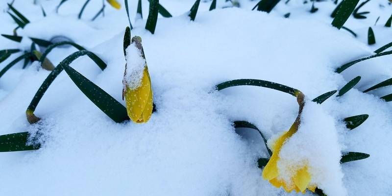
On the heels of a very winter-heavy March, I called for more of the same during the month of April. A stubborn jet stream pattern that kept a continuous stream of cold arctic air pouring into the Midwest was expected to linger indefinitely into the month of April, with several chances for accumulating snow possible as well.
Unfortunately, that’s exactly what we got. April 2018 finishes as one of the coldest on record in Champaign-Urbana. Our average temperature for the month was 45.1 degrees, which is 6.9 degrees colder than average. Precipitation came in under our monthly average of 3.68”, with only 2.32” of precipitation falling. The drier month was a bit of a relief at least, after very rainy weather in February and March left us nearly saturated.
Early on, it was clear that this April was no friend of ours. The month began with 10 of the first 11 days being colder than average, with all but one of those days being more than 10 degrees colder than average. Snow also fell on five of the first 10 days of April, most of which falling on April 2nd when 4.1” of snow was measured in C-U.
A brief, but intense warm-up arrived mid-month with temperatures climbing to near 80 degrees on April 12th. It was only temporary, however, and we cooled back off just as quickly as we’d warmed up. During the final two weeks of April, only two days were not colder than average. Snow also returned to the Twin Cities on April 17th and 19th, bringing our monthly total to 4.9”. Out of 30 days in the month of April, 24 were colder than average. There aren’t a lot of different ways to frame it. April was a really miserable, cold month in the Midwest.
Precipitation was a bit front-loaded in the month of April. Measurable precipitation visited the area fairly regularly during the first two weeks of the month, with rain or snow falling every 2-3 days in C-U. During the last two weeks the pattern changed a bit, with just 0.20” of the 2.32” monthly total falling after April 17th.
An early look at the month of May has us warming up! We’re off to a warm start during the first week of May, and that looks to continue for the most part. We’ll see typical spring fluctuations which can at times bring chilly weather – the difference being that the chilly weather doesn’t linger for weeks.
By the end of May, I expect us to be concluding a month of above average warmth, and slightly below average precipitation. The severe weather season has been extremely quiet thus far across the Midwest thus far, and there are some signals that activity could begin to pick up during the late part of May into June. That’s a bit tougher to call, but something to keep in mind as we head into the peak part of severe weather season in our area.
Andrew operates Chambana Weather, where he publishes daily weather information for Champaign-Urbana and surrounding communities. He is also an agricultural meteorologist with Agrible, Inc. at Research Park, focused on domestic and international weather and its impact on ag.
Champaign-Urbana monthly climate statistics are courtesy of the Illinois State Water Survey.
Photo by Andrew Pritchard


