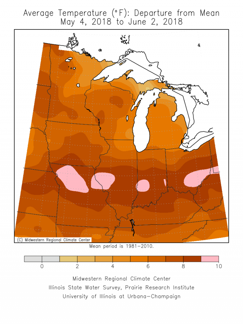
At the end of April, I remarked that May would likely get off to an early warm start that may continue for much of the month. Forget much of the month, it stayed warm for the entire month.
May began warm in C-U, and it stayed warm. Every single day. Of the 31 days in May, all 31 finished with above average temperatures. This has literally never happened before. It also makes that portion of this write-up where I track the trends in temperatures pretty simple. The average temperature for the month of May finishes at 71.1 degrees, which is a whopping 8.6 degrees above average. By comparison, this May finishes over 10 degrees warmer than May 2017 and more on par with the average warmth found during the month of June, or late August.
This was the first time since records have been kept that all 31 days in the month of May have finished with above-average temperatures. Out of those 31 days, 12 of them finished with average temperatures 10-degrees or more above average. A record high temperature was set on the 28th when we reached 96 degrees, surpassing the old record of 94. This came during a week in which we experienced 90-degree temperatures four different days.

My prediction for precipitation in May was that we would come up slightly below-average, and that ended up just about right. We finish the month with 3.45” of precipitation, which is 1.44” below our average of 4.89”. It rained on 12 of 31 days in May, the biggest single dose coming on the 10th, when a severe thunderstorm dumped 1.23” and a little wind-blown pea-sized hail on the twin cities.
Severe weather season peaks in the months of April, May, and June in the state of Illinois, and that department has been quiet not just locally, but nationally. We’re still yet to find ourselves under our first Tornado Watch in Champaign County. There’s some indication perhaps we could see a flip to a weather pattern that supports more frequent thunderstorm clusters across the Midwest during the middle to late parts of June, but it does appear we’ll finish the year with a pretty quiet peak severe weather season overall. It only takes one bad storm to make a lasting impression on a year though, so don’t let your guard down completely.
We went from a bitter cold April and then flipped the furnace to high in May – so what does June have in store? Unfortunately, most signs point to a continuance of the very warm weather for the most part. This at least seems to be true for the first half of June. There is some faint indication that we could find a bit more variety in the jet stream during the last half of the month, which could bring more fluctuation to the temperature department. I’ve got trust issues in that regard for now. The long-range weather models have continually hinted at a pattern change in the 2-week time frame and then time and time again they change their minds and flip back to this same pattern. Remember when that was the case during the bitter cold weather we experienced during the late winter and early spring? The long-range weather models hinted and hinted at warmer weather, only to take it away at the last moment. It’s been a fairly frustrating year to be a meteorologist trying to get any handle on the weather outside of the next 1 to 2 weeks. So, warmer weather finally arrived in May, and there’s no major sign it’s leaving any time soon outside of short spurts of cooler days.

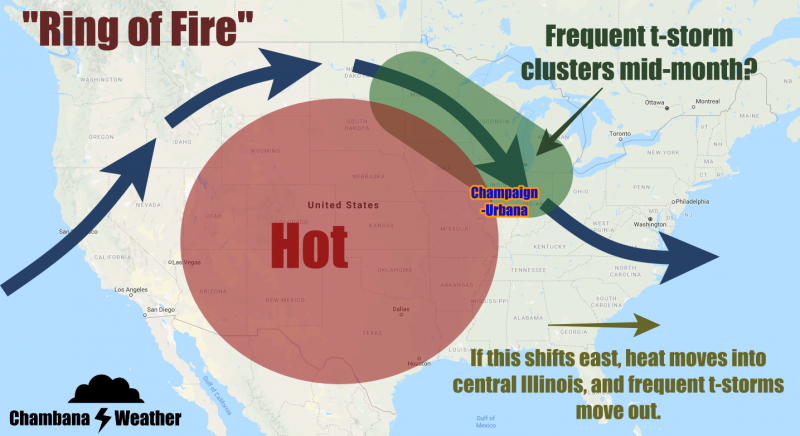
My prediction for June is another month with above-average temperatures, and slightly below-average precipitation. If there is any hope for variety in our weather pattern – i.e. fluctuations in the temperature department, and frequent thunderstorm clusters – it’s going to come around mid-month. There are some indications we could shift into what’s known as a “Ring of Fire” weather pattern, where thunderstorm clusters develop across the Dakotas, and then ride along the outside edge of the dome of heat centered on the Central US into the Midwest. If this dome of heat sets up further east however, we miss out on those thunderstorms, but get all of the heat. Until then, hydrate yourselves and those gardens. June could be another warm and dry one.
Andrew operates Chambana Weather, where he publishes daily weather information for Champaign-Urbana and surrounding communities. He is also an agricultural meteorologist with Agrible, Inc. at Research Park, focused on domestic and international weather and its impact on ag.
Champaign-Urbana monthly climate statistics are courtesy of the Illinois State Water Survey.
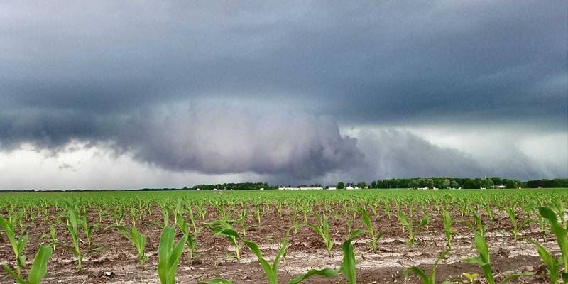
Photo by Andrew Pritchard


