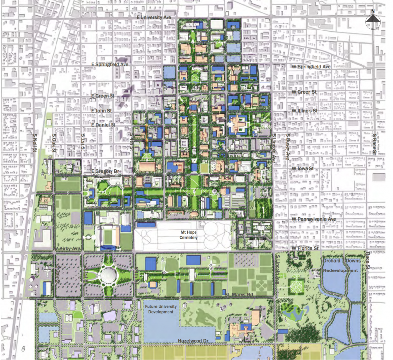
Last year, the University of Illinois revealed an ambitious ten year proposal to expand and shape its campus. The plan announced new initiatives and proposals such as a new autonomous vehicle corridor along Matthews and a new quad around the Armory. It’s ambitious, as is the estimated $1.2 billion price tag to complete new construction, landscaping, and building renovations.
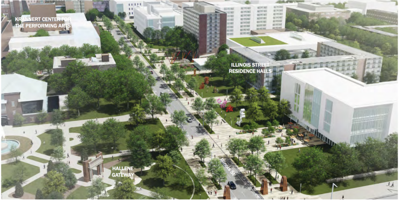
The campus of the University of Illinois was once extremely linear; roughly bound by Matthews on the east, Wright to the west, University to the north, and Armory to the south, the distribution of campus buildings was tall and skinny, much like the State of Illinois itself. South of Armory (or roughly around Nevada on the Urbana side) the campus retained a more standard, rectangular tract of land for future growth stretching from Lincoln Avenue to the railroad tracks. This area was soon filled with buildings like the Stock Pavilion and Architecture Building, eventually becoming the South Quad, Six Pack, ACES campus, Krannert Art Museum, and various other academic and residential buildings. Similarly, the campus expanded outwards around the Main Quad, but this time at the expense of adjacent neighborhoods. The Krannert Center for Performing Arts, Illinois Street Residence Halls, and Spurlock Museum were once a neighborhood much like the rest of West Urbana, consisting of single-family homes on a neat, tree-lined street grid. The Champaign side also redeveloped in a disjointed manner and it remains a hodgepodge of businesses, residences, and university buildings strewn across a disjointed topography of parking lots, particularly along Fifth and Sixth Streets.

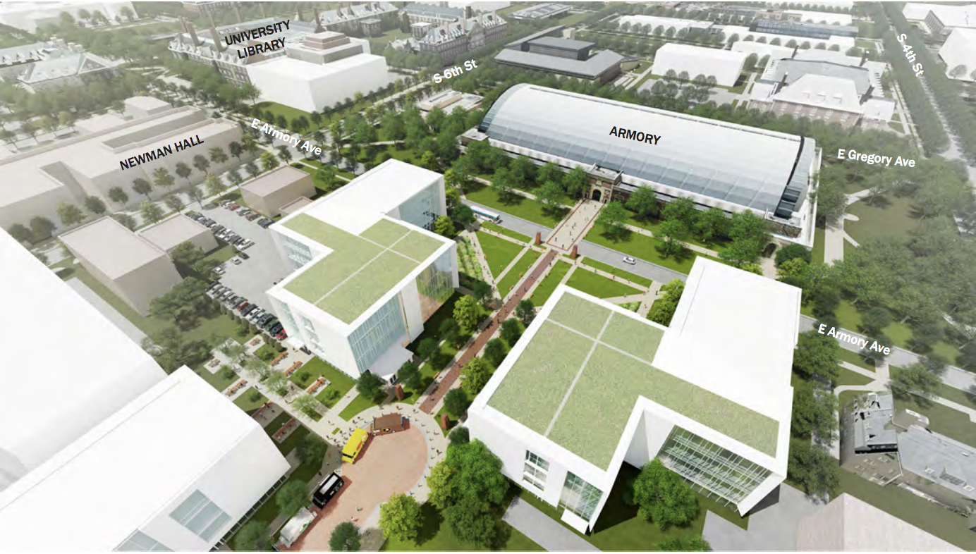
A newer, denser campus that would fill in the blotches of parking lots is outlined in the master plan. Much of the parking is to be consolidated into garages, while many of the surface lots will be replaced with new buildings or green space. A fifth quad (in addition to the North, Engineering, Main, and South Quads) was proposed north of the Armory, requiring the demolition of the Ice Arena, which would be replaced with a new facility near Memorial Stadium (the proposed downtown arena may throw a wrench in these plans, though). An expansion of the Illinois Street Residence Halls is also notable, as it will be part of a huge redevelopment of the Green and Lincoln area, updating and expanding graduate housing. Even now, the redevelopment of the Six Pack into the Ikenberry Commons, replacing all of the mid-century dormitories with modern residence halls and a central green space, is already underway.

A denser flagship university will weave together the patchwork of buildings, parking lots, non-university buildings, and green space that is prevalent throughout the campus. Although UI has never been hesitant to exercise its power to utilize eminent domain, demolishing neighborhoods of single family homes for the purpose of academia throughout the 20th century, the master plan signifies a shift in campus planning focus, opting instead to build on underutilized land already owned by the institution.
By not acquiring new land for the tax-exempt buildings, the university’s expansion will not have an adverse effect on the property taxes of C-U residents; however, if the university continues its growth, it is likely that even more student apartments will spring up to meet the housing demand for future students. This phenomenon is known as “studentification,” which occurs when traditional neighborhoods become oriented towards college students, altering the character and demographics of the neighborhood. Examples of rapid neighborhood change can be seen around the twin cities, from new apartments on University Avenue to new apartments along Lincoln in Urbana, to a medley of projects near the Second Street Basin. Since much of the area’s student housing is private, it is difficult for the University to control or plan for these new developments. And as more students seek housing near UIUC, it is possible that this accelerated redevelopment of UI’s peripheries could eventually lead to the displacement of some longtime residents, particularly in North Urbana and Champaign.
Back on campus, Matthews Street is proposed to transition to a car-free corridor, introducing cycle lanes and dedicated right-of-way for autonomous vehicles; earlier drafts have even suggested running a streetcar down Matthews. While it is hard to deny that a streetcar would be an objectively cool addition to Champaign-Urbana’s landscape, financing the capital cost of such a project (or justifying federal funding) in a relatively small metro arena would be highly unlikely. In contrast, less-expensive autonomous vehicles are seemingly in vogue; University of California, Berkeley has proposed such a system for its campus and experimental projects in the past such as West Virginia University’s 1970’s-era Personal Rapid Transit system have been regarded as successful.
While the ten-year timeline may be unrealistic, the fulfillment of elements of the master plan is underway. The development of the Siebel Center for Design is one of the most recent projects announced by the school which will open in 2020, located on what was once a grass field adjacent to the Krannert Art Museum. Similarly, the new Bruce Nesbitt African-American Cultural Center will be rebuilt on the site of its former building. Other small-scale building expansions across campus are also inching the master plan closer to reality. As the University continues its expansion, it remains to be seen just how the community will be affected; as residents, university-related or “townies,” keeping in the loop with the happenings of the execution of the plan will help ensure that the University continues to work to the community’s benefit, not to its detriment.
To read more on the campus plan, visit the University Office of Capital Programs and Real Estate Services’ master plan page.
All images from master plan technical report


