There’s an old addage, “if you don’t like the weather in central Illinois, wait 5 minutes!” With the ever changing, never boring weather we’re treated to here in Champaign-Urbana, it can be a bit difficult to remember the weather we experienced over the course of an entire year. You’ll find though, that at times the weather in 2018 you could forget about the weather changing in 5 minutes, we were looking at 5 weeks of the same weather. It was a year of stubborn weather patterns that, whether we liked them or not, were here to linger. Let’s take a look back.
We started off 2018 in frozen fashion. Cold air invaded the Twin Cities over the holidays and lingered through the first half of January. We even managed to string together two consecutive weeks where we never once saw the air temperature outside warm above freezing, or 32 degrees F. On New Year’s Day we enjoyed an afternoon high temperature of a balmy -3 degrees. Four other days featured high temperatures in the single digits.
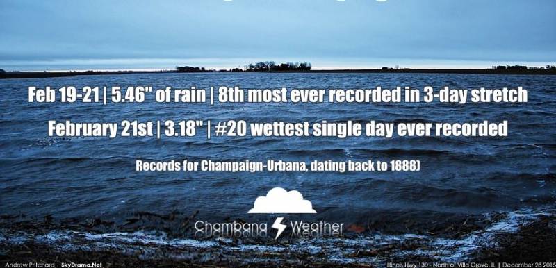
Then came February. Warm, rainy February. With 6.12″ of precipitation we nearly doubled our monthly average. Not much of that came in the form of snow, however with much of the month spent much warmer than average. We managed several days with high temperatures in the 60s, which is over 20 degrees above average for that time of year. So, we’re off to an early spring, right?
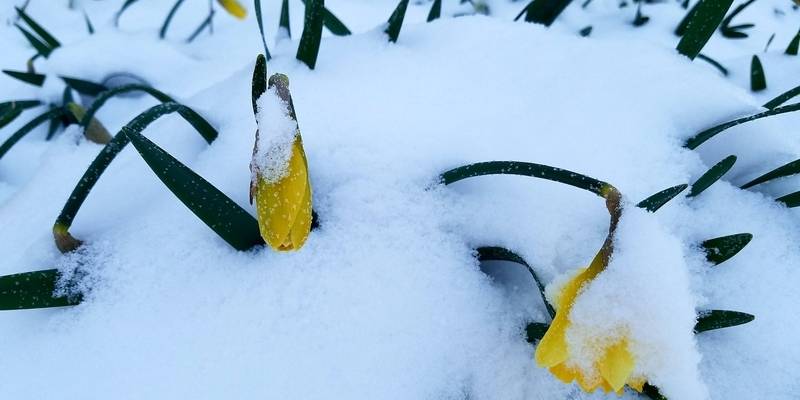
March came in a bit colder, but nothing like the month-long April Fool’s joke that the month of April became. After a warm and rainy February instilled dreams of an early spring, winter got the last laugh. The biggest single day snowfall in 2018 fell on April 2nd in Champaign-Urbana when we measured 4.1″ of snow. The snow kept coming all the way until April 19th. That’s the anniversary of the largest tornado outbreak in the state of Illinois, by the way. Anniversary of the biggest tornado outbreak, and the largest snowfall of the year falling on the same date? That’s Central Illinois for you!
In addition to running Chambana Weather, my work is focused on agricultural weather. With snow and cold temperatures lingering into late April, farmers in the area began getting nervous that they would be getting their crops into the ground late. Can’t plant in frozen, snow-covered soil, after all!
May erased those fears. Big time. I posted this stat back in my May Monthly Weather Review, but the month of May featured exactly ZERO days that were colder than average. For the first time in recorded history, all 31 days in May were warmer than average in Champaign-Urbana. We came by it honestly, too. Many of the days were much warmer than average, culminating with several days in the mid to upper 90s in late May.
Keeping farmers in mind, they loved what followed in June. After a successful May planting, June brought the rains to soak the soil and get crops off to record fast starts. June was the wettest on record here in Champaign-Urbana, with over 8 inches of rain! That’s almost double the monthly average.
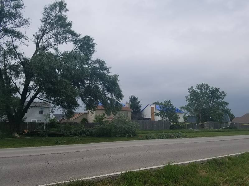
June thunderstorms brought tornadoes to the area as well, which is seasonally appropriate. On June 10th the weather made the news when a brief tornado struck a southwest Champaign neighborhood seemingly without warning. This spurred a major debate over the outdoor warning sirens in Champaign-Urbana and what role they should serve in the modern age. (Hint: stop relying on them, they’re outdated technology that is meant to alert folks who are outdoors that it is no longer safe to be outside, and to head indoors for more information.) On June 26th seemingly benign rain showers passed over Champaign-Urbana and intensified into a cluster of thunderstorms that produced a highly visible tornado near Thomasboro and Rantoul that was illuminated in a beautiful pink color at sunset.
July was about average overall, but did so by dividing itself in half; a hot first half, and a cooler second half. July 18-31 never featured a warmer than average day. Otherwise, July and August came and went with a fairly typical end to our summer season in the Twin Cities.
September came in a bit hot, with 90 degree heat lingering late into the month. Mother Nature has a way of balancing things out though, and that 90 degree heat was nothing but a distant memory when we saw a high temperature of only 58 degrees on September 29th.
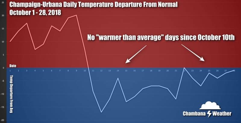
October was another example of the weather getting stuck in a certain pattern and refusing to change. From October 1-10, every day was warmer than average. October 11-31? All colder than average.
There’s that theme that rang true for much of the year. February’s warmth. March through April being stuck in the winter dumps. All 31 days of May being warmer than average. June bringing daily thunderstorms and record rains. It just seems that more and more, particular weather patterns are settling in and instead of paying us a quick visit, they’re locking in and hunkering down for weeks. Is this the new norm, or is it a theme that will leave us behind in 2018? That’s something I’ll be watching as we head into a new year of weather in C-U.
Winter was ready early this year, with a bitterly cold month of November. Remember when we hit a record low temperature of -17 degrees on November 10th? Yeah, I’ve done my best to try and forget that, too.
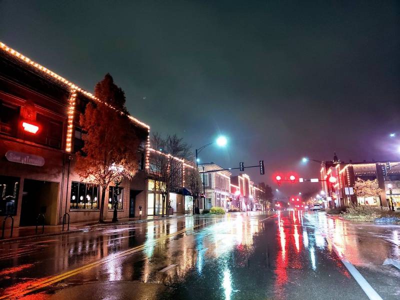
From November 9-20 we never saw a temperature above 40 degrees. Now consider that the average high temperature for mid-November should be in the middle 50s, but we were hanging out in the 20s and 30s each day! Not only was November cold, it was gloomy too. We saw clouds and precipitation on 22 of 30 days. Pass.
And then there was December, a wildly dynamic month. December 1st saw the 3rd largest tornado outbreak in Illinois history, with major tornadoes hitting Taylorville and Beardstown. The tornadoes missed the Twin Cities, but we enjoyed a high temperature in the middle 60s with nighttime thunder as the tornado producing storms moved through our area that night. Unfortunately, even with a cold finish to the month we didn’t get that last minute accumulating snow for the holidays. December averages 6.6″ of snow each year, but December 2018 only mustered 1.6″, almost all of which fell during the first week of the month. At least holiday travel was easy!
So in 2018 winter was stubborn to leave, and eager to return, but sandwiched in between were a hot May, a stormy June that brought local tornadoes, and a mostly normal summer.
I so look forward to riding out another wild year of Central Illinois weather with you all, and all the surprises that it brings with it!
Andrew operates Chambana Weather, where he publishes daily weather information for Champaign-Urbana and surrounding communities. He is also an agricultural meteorologist with Nutrien Ag Solutions at Research Park, focused on domestic and international weather and its impact on ag.
Champaign-Urbana monthly climate statistics are courtesy of the Illinois State Water Survey.
Photos by Andrew Pritchard


