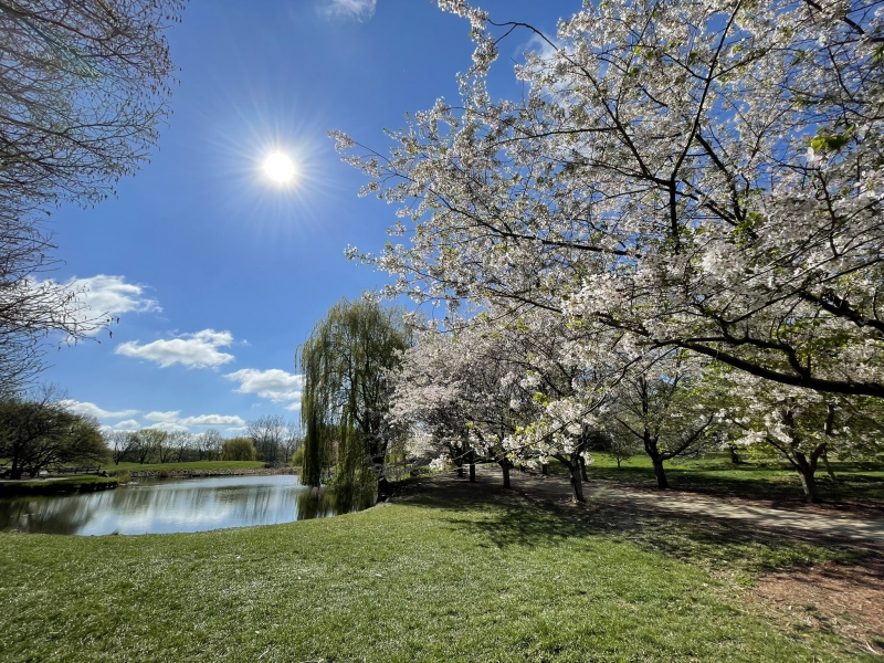
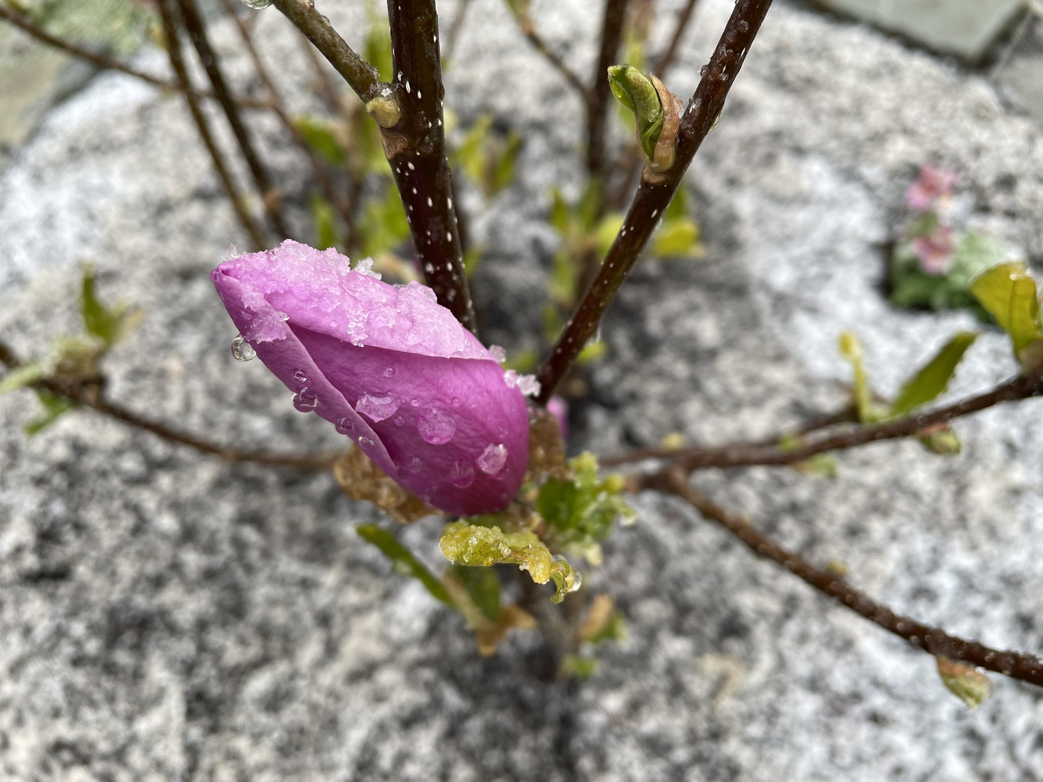
We’re entering the final month of climatological spring, but it feels like this particular spring has been full of false starts. I’ve seen that meme about “3rd winter” circulating on my social media feeds more times than I can count. In what feels like a growing trend during the month of April in the Midwest over the last few years, a big area of low pressure centered over the Great Lakes delivered record breaking cold and some late-season snow to Champaign-Urbana.
April 2021 actually finished quite close to average, just 0.6 degrees above the April mean of 52 degrees. We were able to do that even with the mid-month chill by getting off to quite the balmy start. We saw back to back 80 degree days in C-U on April 6th and 7th with several other days in the middle to upper 70s sprinkled into the first two weeks of the month as well.

Photo by Andrew Pritchard.
Change came slowly at first, with daily high temperatures cooling back into the 50s and 60s April 10-19. This stretch of mid-April featured some gorgeous days, even if they were a bit chilly. Brilliant blue sky and bright sunshine for days on end. The big freeze arrived on April 20th, with three consecutive nights of sub-freezing 30 degree low temperatures. The high temperature of 39 degrees on the 20th set a new record for the coldest high temperature recorded on that date, breaking the previous record of 43 set in 1978. Snow fell on the 21st, with a snow depth of 1″ being recorded the next morning.
I’m going to side step the joke about waiting 15 minutes if you don’t like the weather in Central Illinois, but change did come quickly as it often does. Five days after record breaking cold and some snow falling in Champaign-Urbana, it was 83 degrees on April 27th.
The temperature trend line for the month of April in Champaign-Urbana would be shaped a bit like a V, with warm stretches to begin and finish the month and a mid-month chill in the middle.
April 2021 was quite dry compared to average in Champaign-Urbana, falling over an inch and a half short of the monthly average of 3.68″ with just 2.11″ being tallied for the month. We had rainy stretches from April 8-12 where it was more cold and drizzly than anything, and again April 19-22 where we saw a wintry mix of snow, graupel, sleet, rain, and freezing rain. Rain showers on April 28-29 closed the book on April precipitation.
April was also extremely quiet on the severe weather/thunderstorm front with not a single rumble of thunder being reported in Champaign-Urbana all month. In fact, severe weather has been quite the stranger locally all spring. Severe storms in Central Illinois missed C-U on March 27th, and it wasn’t until another round of strong storms missed the Twin Cities to the south on May 3rd that severe weather returned to Central Illinois.
Will that quite severe weather trend continue deep into May? Will cold air be back?
To be quite honest, medium range weather models have performed extremely poorly this spring. We’ve often seen a warm and stormy pattern advertised 10-14 days out, only to have the pattern shift once we draw a little closer.
We’ve got another push of cold air headed for the area heading into the second week of May. While I think we’ll avoid a frost or freeze this far south, several days with overnight lows in the upper 30s are possible May 8-11. It does look like temperatures begin to warm back to seasonally average levels once again in mid-May, which would have our overnights in the middle 50s and afternoons in the upper 70s to near 80 degrees.
Precipitation remains a tough call. Much of our rainfall this time of year comes from thunderstorms, and the overall jet stream pattern which largely dictates where thunderstorm activity is concentrated has remained tough to pin down. Beyond day 7 or 8, much of the model guidance begins to wash out and contradict itself. In that case, using a persistence based forecast is often useful. The trend has clearly been to push shots of cooler air into the Midwest with stretches of sunny and drier weather, and I think that continues to be a theme at least for another 2 weeks. Ultimately, I think May 2021 finishes very near average in terms of temperatures as we ride the rollercoaster for another 14-21 days.
I think we’ve got a better shot at coming out on the wetter side of average for the month of May with a late-month rally. We’re going to get a nice drink this weekend from a storm system passing through the Ohio River Valley, and there’s promise of additional storm systems sweeping through every 3-6 days bringing renewed chance for showers and thunderstorms.
The frequency of severe weather in Central Illinois through the month of May and into June, our climatological peak season for severe weather locally is a bit harder to call. The advertised jet stream pattern at 1-2 weeks out has had a perpetually active look to it, only to fall apart as it draws nearer. That said, I do think the Midwest trends a little more volatile the last half of May into early June. This is of course a much more nuanced forecast element and will have to be addressed storm system by storm system.
So, we’ll call for a May that is near average in terms of temperatures with slightly above average precipitation and potentially active last half of the month with respect to severe weather. For context, the monthly mean temperature for May in Champaign-Urbana is 62.5 degrees (highs in 70s, lows in 50s) and the average May precipitation is 4.89″.
Andrew operates Chambana Weather, where he publishes daily weather information for Champaign-Urbana and surrounding communities. He also serves as Senior Meteorologist with Nutrien Ag Solutions at Research Park, focused high impact weather events and their impact to agriculture in the U.S. and Canada.
Champaign-Urbana monthly climate statistics are courtesy of Illinois Water Survey.


